THE COUSTEAU RESERVE, IN A NUTSHELL :
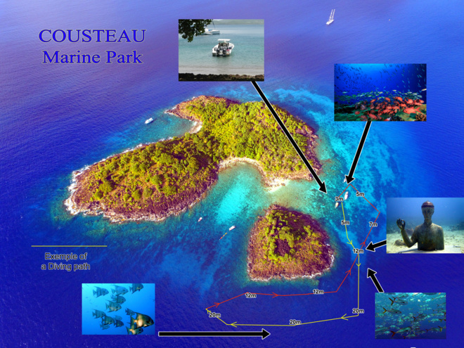
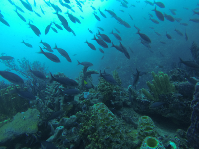
The Cousteau reserve is part of the Guadeloupe National Park created 30 years ago or so with a view to protecting the extraordinary floral and animal life of Ilets Pigeon and their vicinity. Fishing and underwater hunting are thus banned (as are boat and yacht anchoring by the way), thereby allowing fish and coral to peacefully develop into the unique biodiversity shrine that owes the Cousteau reserve such appraisal amongst many divers!
The Cousteau Reserve is a perfect place to do a DIscover Scuba Diving, an exploration dive
or starting a PADI diving certification
HOW DIFFERENT ARE CYCLONES, TYPHOONS AND HURRICANES?
Depending on their geographical area of influence, the three words designate the same tropical-borne swirling phenomenon, whirling winds of over 118km/h (75mph).
. In the Indian Ocean and South Pacific they are known as Cyclones, but
. Hurricanes in the North Atlanticand in the North East Pacific,while
. Typhoons qualify the same phenomena in the North West Pacific.
CYCLONIC SEASON:
In the North Atlantic and West Indies, the cyclonic season commences on 1 June and stretches out to end-November. Over the past 20 years, Guadeloupe has been preserved from major hurricane aggressions (meaning a direct hit from the weather system’s “eye”) – the last one being Hugo back in 1989. Of course, other phenomena did show their ugly faces since, like Marilyn in 1995, a Class 1 hurricane with a similar path to Maria’s, yielding massivedownpours and 130km/h (85mph)windbursts across Basse Terre; followed by Lenny in 1999, which generated a strong swell along the shoreline and scarred the littoral areas; Dean in 2007, which hit Martinique and dealt a few good windbursts to Guadeloupe; and finally Omar in 2008, whose cyclonic swell slammed hard onto the littoral as Maria did later. No less than an average of 14 depressions are expected every year, though most with sub-tropical stormratings.
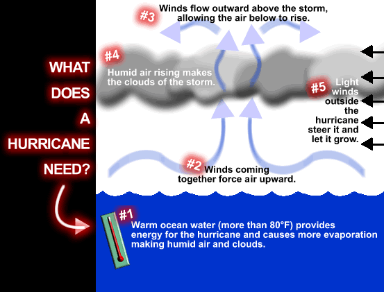
Unlike tornados, hurricanes always originate at sea- and more precisely above equatorial oceans, fromexisting cloud formations or turbulent areas.
According to Nasa two ingredients are required for a hurricane to form: “One ingredient is warm water. Warm ocean waters provide the energy a storm needs to become a hurricane. Usually, the surface water temperature must be 26 degrees Celsius (79 degrees Fahrenheit) or higher for a hurricane to form.
The other ingredient is winds that don't change much in speed or direction as they go up in the sky. Winds that change a lot with height can rip storms apart.”
The Ocean must thus have a temperature of at least 26°C down to a depth of 50m to qualify as hurricane fuel.
In the wake of a hurricane, sea temperature drops by 0.2 to 1.2°C, depending on a number of factors such as hurricane displacement speed, intensity and season. http://www.cyclonextreme.com
If you plan on a diving trip to Guadeloupe, always check the pros and cons offered by every season (see our related article here...in French only).

How do hurricanes occur ?
HURRICANE MARIA SWEEPS ACROSS GUADELOUPE:
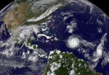
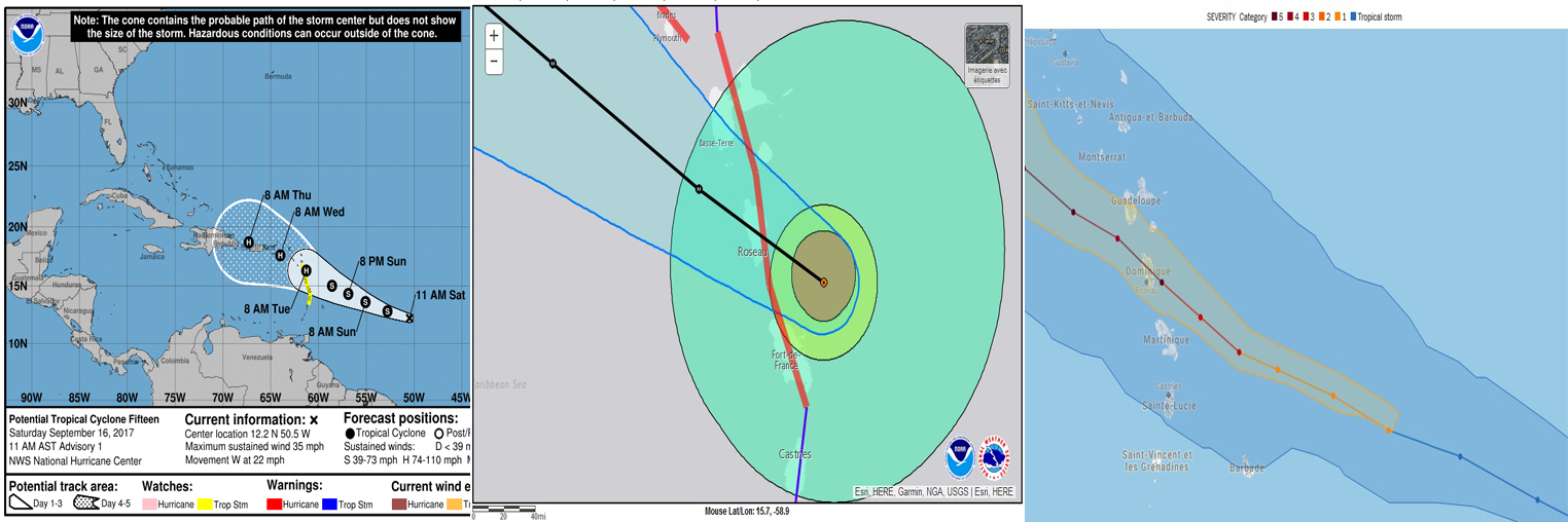
Hurricane Maria’s eye passed 30km south west of Guadeloupe’s coasts with winds averaging speeds of 135km/h (85mph) and gusts of up to 200km/h (125mph) and more at higher altitudes.
According to early forecasts, the hurricane’s aim was to strike a bull’s eye on Guadeloupe, creating waves of up to 10 metres (30 feet). Luckily, one day prior to its arrival, it nudged eastwards just about preserving us from seeing its eye sweeping across Basse Terre.
What made Maria unique is not only its transition from tropical storm to Class 5 hurricane in less than 24 hours, but also its trajectory which, unpredictable till the end, caused it to climb straight towards Guadeloupe for several hours, than to descend towards Dominique before swerving northwards again and finally stir south, leaving a sickening suspense hover over the islands’ inhabitants regarding their immediate future.
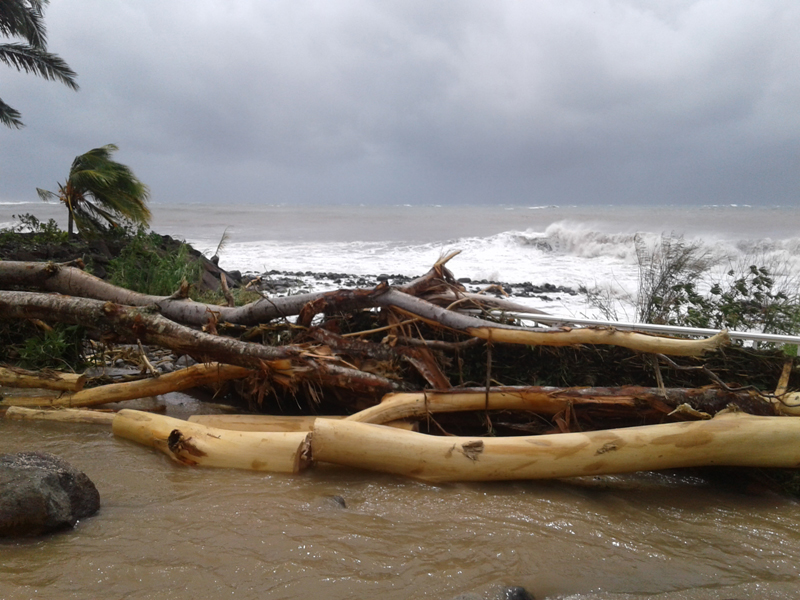
As for the sea, the waves that eventually hammered Bouillante’sembankments and shores were only 5 to 6 metres (18 feet) tall and only the froth of the taller waves made it above the Cousteau reserve’s smallest island – a far cry from Hugo’s or Lenny’s waves. Not only were there torrential rains (163mm in 24 hours in Basse Terre against 48mm in Paris during the whole of March), but also overflowing rivers and several landslides.
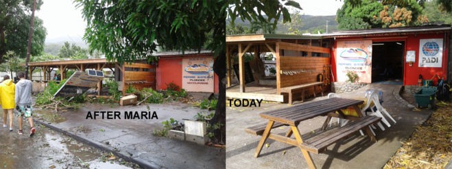
Guadeloupe is a French and modern island so, a week later, the wounds left in the wake of the hurricane had already greatly healed!
…………………………THE COUSTEAU RESERVE SITE BY SITE…………………………….
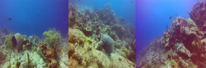
This is an initial description of the Cousteau reserve’s sites in the aftermath of hurricane Maria
This is an initial description of the Cousteau reserve’s sites in the aftermath of hurricane Maria
AQUARIUM (ILETS PIGEON)
Aquarium was amongst the least exposed sites to hurricane Maria’s swell. A few rocks were displaced from the site towards the beach, and the magnificent elkhorn coral that stood at 3 metres depth near the yellow buoy has fallen.
Check here "the Elkhorn Coral" on the Cousteau Reserve
Luckily, it is the only significant loss endured by the site!
On a sweeter tone, the hawksbill turtles are still very much among us, as are the barracudas and many other fish species.
JARDIN DE CORAIL (ILETS PIGEON)
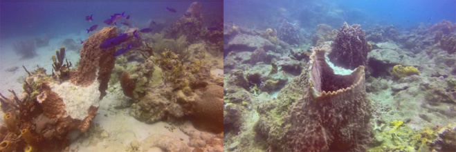
The worst was to be feared for Jardin de Corail, but luckily it survived better that expected. We won’t conceal the truth though as indeed a number of corals have suffered, some elkhorns have vanished and the giant barrel sponges have paid a heavy toll.
Check here for "giant barrel sponges" on the Marine Park
In spite of this, the site has for the most part been preserved: morays, lobsters and parrotfishes are still animating the site under Commander Cousteau’s watchful eyes.
In the end, Jardin de Corailstill remains a favourite for your christenings and initial dives.
THE COUSTEAU RESERVE WRECKS: FRANJACK AND GUSTAVIA
The wrecks of the Cousteau reserve have not suffered from hurricane Maria’s strike. The Franjack hasn’t budged, though the port flank got somewhat sanded up and the wreck got littered with branches and plastic bags. A little TLC will bring her back to her former glory! The wreck bristles with life: crabs, lobsters and firewormsare alive and kicking!
As for the Gustavia, her depth (40 meters or 120 feet) was her shield: she didn’t bat an eyelid!
JARDIN JAPONAIS, ANSE NEGRESSE AND POINTE MALENDURE (COUSTEAU RESERVE’S NORTH COAST)
In spite of the swell’s heavy pounding on this part of the coast, Jardin Japonais, AnseNegresse and Pointe Malendure have not greatly suffered and the northern coast’s character is well preserved, with plenty of life and fish galore.

Jardin Japonais and Point Malendure
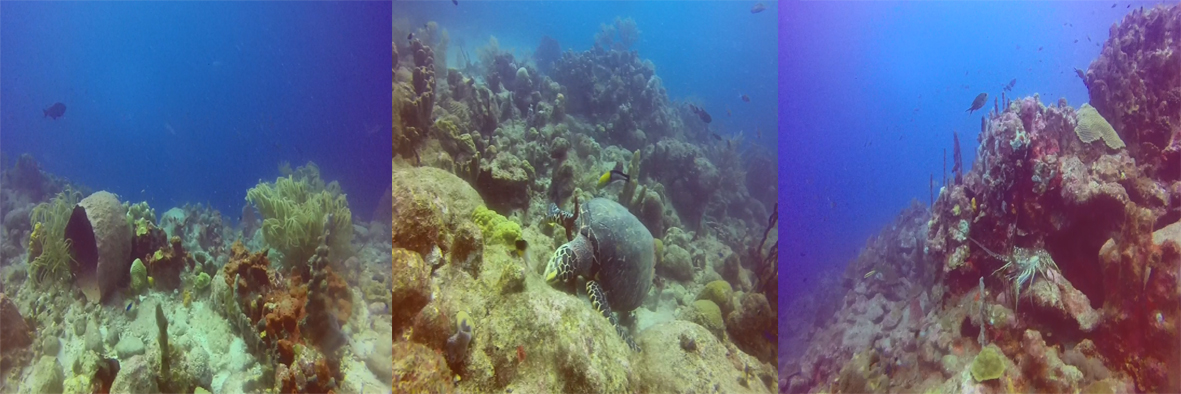
A VIDEO MEDLEY OF RESERVE COUSTEAU’S SITES ONE WEEK AFTER CLASS 5 HURRICANE MARIA’S VISIT
Planning a visit to Guadeloupe for All Saints Day hols?
Book your Maria Special dive
so that we can make you a direct witness.
Book your Maria Special dive
so that we can make you a direct witness.
And if you want to have a look of what the Cousteau Marine Park sealife is like : CHECK HERE

